
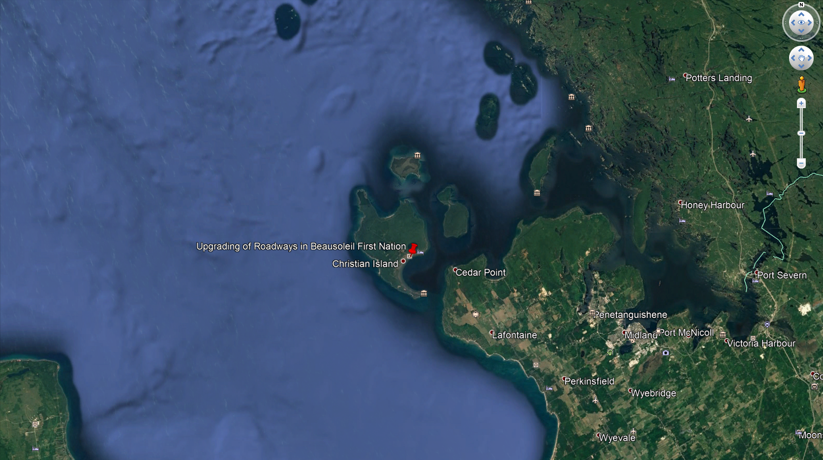
Upgrading of Roadways in Beausoleil First Nation
This is a non-designated project on federal lands or outside Canada. The listed authorities are responsible for the project assessment.
The project will upgrade approximately 17.2 kilometres of roadway in Beausoleil, Ontario. The upgrades will involve the installation of sidewalks and a ditching system, rehabilitation of the sub-grade, and asphalt surfacing of the roadway and shoulders from O-Gema Road to Kate Kegwin Road (0.35 kilometres), with the remaining roads and shoulders (16.85 kilometres) paved with a double surface treatment. The project will improve road safety and reliability for drivers, cyclists and pedestrians, support better traffic flow, facilitate active transportation, reduce operation and maintenance costs, and extend the life of the assets.
Latest update
2020-08-17 – Infrastructure Canada issued its Notice of Determination and determined that the project is not likely to cause significant adverse environmental effects.
Participate
Contacts
Aboriginal Consultation and Environmental Services1100 - 180 Kent St
Ottawa, Ontario K1P 0B6
Email: infc.aboriginalconsultenv-consultautochtonesenv.infc@canada.ca
Infrastructure Canada
Meng Koh, Senior Environmental Review and Approvals Officer
180 Kent Street
Ottawa, Ontario K1P 0B6
Telephone: 343-551-0418
Email: meng.koh@infc.gc.ca
-
Location
- Beausoleil First Nation Reserve (Ontario)
-
Nature of Activity
- Highways and Roads
-
Assessment Status
Completed -
Start Date
2020-05-27 -
Proponent
Beausoleil First Nation -
Authorities
- Infrastructure Canada
-
Assessment Type
Project on federal lands -
Reference Number
80721
Disclaimer
This map is for illustrative purposes. The markers represent the approximate locations based on available data. More than one marker may be identified for a given assessment.
Nearby assessments
...within 200 kilometres-
Beausoleil First Nation - Stormwater System Upgrade and Existing Drainage Rehabilitation
Beausoleil First Nation Reserve -
Impeed the Reed
Georgian Bay Islands National Park -
Tobey Dock Reconstruction
Georgian Bay Islands National Park -
YMCA Camp Queen Elizabeth Cabin Improvement Project
Georgian Bay Islands National Park -
Honey Harbour Parking Lot
Georgian Bay Islands National Park of Canada -
Thornbury Harbour Fuel System Removal and Replacement - 2021
Thornbury Harbour -
Thornbury West Pier Deck Repairs - 2021
Thornbury -
Septic (Holding Tank) Installation at Port Severn ON Post Office
3280 Port Severn Road South, Port Severn, Ontario -
White's Portage Dam Replacement, Trent-Severn Waterway
Trent-Severn Waterway National Historic Site -
Ontario Waterways, Six Mile Lake Dams Rehabilitation
Trent-Severn Waterway National Historic Site of Canada -
Wahta Mohawk Housing Subdivision Project
Wahta Mohawk -
Wahta Mohawks - Waste Transfer Station and Landfill Closure
Wahta Mohawks -
Meaford Harbour - Dock Expansion Project
Meaford -
Meaford Harbour Fuel Tank System Installation - 2021
Meaford -
Cassino Range Improvements - 4th Canadian Division Training Centre (Meaford)
4th Canadian Division Training Centre (Meaford) -
Paardeberg Range Improvements - 4th Canadian Division Training Centre (Meaford)
4th Canadian Division Training Centre (Meaford) -
4th Canadian Division Training Centre (Meaford) North Shore Road Erosion Control
4th Canadian Division Training Centre (Meaford) -
Bala North Dam Waterpower, Lake Muskoka, Township of Muskoka Lakes
Bala -
Soil Remediation at Jannacks Narrows Minor Shore Light, Bala Park Island, Ontario
Jannacks Narrows Minor Shore Light, Ontario -
Wasauksing First Nation - Supply Island Lighthouse Demolition and Remediation
Supply Island Lighthouse -
Wasauksing First Nation - Lot Servicing for future houses
Wasauksing First Nation -
Wasauksing First Nation Peatland Wastewater System Design & Construction
Wasauksing First Nation Peatland Wastewater System Design & Construction -
Canadian Coast Guard Parry Sound Base Helipad Area Repair Project
Parry Sound -
Replace Selected Exterior Hardscape, Retaining Wall and Fence
48 Owen Street, Barrie, Ontario -
Private Landowner Shoreline stabilization, Trent-Severn Waterway, Shoreline Works Permit 210241, Sparrow Lake, ON
Trent-Severn Waterway National Historic Site -
Private Landowner Shoreline stabilization, Shore wall, Trent-Severn Waterway, Shoreline Works Permit 200013
Trent-Severn Waterway National Historic Site -
Private Landowner Shoreline stabilization, Shore wall, Trent-Severn Waterway, Shoreline Works Permit 200127
Trent-Severn Waterway National Historic Site -
Construction of a Winter Maintenance Yard, Canadian Forces Base (CFB) Borden
CFB Borden (the Site). The Site is located approximately 3 km southwest of Angus, ON. -
Standing Offer for General Construction at CFB Borden, Ontario
Canadian Forces Base Borden -
Break Wall Repairs by private home owner - 318433 Grey Rd 1, Owen Sound Harbour, ON
Owen Sound Harbour -
Full Depth Parking Lot Reconstruction / Repaving at Building P-148
Canadian Forces Base Borden -
Stormwater Outfall #21 Repair at the Catawampus Pond - Canadian Forces Base (CFB) Borden, Ontario
Canadian Forces Base (CFB) Borden -
Construction and Operation of a new Gas Hut - Canadian Forces Base Borden
Canadian Forces Base Borden -
New RV Compound at CFB Borden
Canadian Forces Base Borden -
Construction of Eight Apartment Buildings - Canadian Forces Base Borden
Canadian Forces Base Borden -
Construction and Operation of a Transition Centre at CFB Borden, Ontario
Canadian Forces Base Borden -
Pad A Demolition at Building T-126 at CFB Borden
Canadian Forces Base Borden -
Potable Water Well Installation; private residence well.
Public Port of Owen Sound -
Construction of 400 Squadron Transition Infrastructure (H-18), CFB Borden
Canadian Forces Base Borden -
Grey and Simcoe Foresters Storage Compound Building, Borden - Ontario
Canadian Forces Base Borden -
Installation of Beaver Baffles in Range and Training Area B2, at Canadian Forces Base Borden
Canadian Forces Base Borden -
Couchiching Lock 42 and Bridge 56 Rehabilitation
Trent-Severn Waterway National Historic Site -
High Speed Driver Training Track Improvements - Canadian Forces Base (CFB) Borden
Canadian Forces Base (CFB) Borden -
Soil Remediation at CFB Borden Firefighter Training Area
CFB Borden Firefighter Training Area which is approximately 3.6 km southeast of Lisle, Ontario -
Chippewas of Nawash First Nation Water System Upgrades
Chippewas of Nawash -
Area E2 Road Construction - Canadian Forces Base (CFB) Borden
Canadian Forces Base (CFB) Borden -
10th Street Bridge Reconstruction, Owen Sound
Owen Sound -
Shilling Subdivision Chippewas of Rama First Nation
Chippewas of Rama First Nation -
Reconstruction of Nawash Unceded First Nation Roads and Culverts
Neyaashiinigmiig -
Chippewas of Rama - Landfill Decommissioning/Transfer Station Construction
Chippewas of Rama -
Highway 69 Four-Laning from North of Highway 559 to North of Woods Road (Project 1)
Carling -
Beaver Creek Institution - Parking expansion
Beaver Creek Institution -
Wiarton Breakwater Replacement
Wiarton Launch Ramp -
Highway 69 Four-Laning from north of Woods Road to north of Harris Lake Road (Project 2)
Harrison, Shawanaga, Wallbridge -
Highway 69 Four-Laning from North of Highway 559 to North of Woods Road (Project 1)
-
Shawanaga First Nation- Construction of Three (3) New Homes
Shawanaga First Nation -
Shawanaga First Nation - Lot Servicing for future houses
Shawanaga First Nation -
Shawanaga First Nation - Water Treatment Plant Upgrades
Shawanaga First Nation -
Town of Shelburne Long-Term Well Project
Shelburne -
Beaver Creek Institution - New/Existing Pump Station Upgrade
Beaver Creek -
Dredging Projects for Six (6) Properties Bordering the Trent-Severn Waterway: (1), Balsam Lake, (2) Buckhorn Lake, (3) Stoney Lake, (4) Pigeon Lake, (5) Balsam Lake, and (6) Sparrow Lake
(6) 3500 Lauderdale Point Cres, Severn, Sparrow Lake, O -
Chippewas of Georgina Island First Nation - Early Childhood Learning Centre
Georgina Island -
Chippewas of Georgina Island First Nation - South/East Region Watermain Extension
Georgina Island First Nation -
Chippewas of Georgina Island - Rehabilitation of Watermains
Georgina Island -
Lion's Head Harbour Dredging Project - Spring 2021
Lion's Head Harbour -
Georgina Island Fixed Link Project
Lake Simcoe between Georgina Island to Town of Georgina in Ontario -
Bradford Bypass Project
West Limits at Highway 400 -
Beaverton Small Craft Harbour Platform Removal
Beaverton, ON -
New Fibre Installation
Saugeen Indian Reserve No. 29 -
Trent-Severn Waterway Durham Regional Road 50 Bridge
Trent-Severn Waterway National Historic Site -
Baldwin East Aerodrome Project
Town of Georgina -
Pefferlaw Small Craft Harbour Tree & Brush Removal
Pefferlaw -
Bradford Bypass Project
East Limits at Highway 404 -
Ontario Waterways-Trent-Severn Waterway Kirkfield Shops Expansion
Trent-Severn Waterway National Historic Site -
Highway 69 Four-Laning from north of Harris Lake Road to north of Magnetawan River (Project 3)
Wallbridge -
Highway 69 Four-Laning from north of Woods Road to north of Harris Lake Road (Project 2)
-
Dyer's Bay Small Craft Harbour - Wharf Repair
Dyer's Bay -
Keswick Post Office Site Remediation
Keswick -
Port Elgin Maintenance Dredging 2021
Port Elgin -
Shaw Farm Decommission
Bruce Peninsula National Park of Canada -
Hidden Valley Road Box Culvert
Bruce Peninsula National Park -
Magnetawan First Nation Underground Storage Tank Removal - Band Office
Magnetawan First Nation -
Private Landowner Shoreline stabilization, Trent-Severn Waterway, Shoreline Works Permit 190274
Trent-Severn Waterway National Historic Site -
Magnetawan First Nation - Wastewater System Upgrades
Magnetawan First Nation -
Magnetawan First Nation - Water Treatment Plant and Storage Upgrades
Magnetawan First Nation -
Highway 69 Four-laning from north of Magnetawan River to north of Highway 607 (Project 4)
Henvey, Mason, Mowat -
Highway 69 Four-Laning from north of Harris Lake Road to north of Magnetawan River (Project 3)
-
Gima Kwe Nong Parking Area
Bruce Peninsula National Park of Canada -
Construction and Operation of Building A-320, at CFB Borden
21c Spitfire Lane, Canadian Forces Base Borden -
Replacement of the Britt Weather Radar
8 Station Road, Britt, Ontario, P0G 1A0 -
Highway 413 Project
Highway 400 -
Dockside Dredge Trent-Severn In-Water and Shoreline Works Permit 190113
Trent-Severn Waterway National Historic Site -
Erin Wastewater Treatment Plant Project
Town of Erin -
Eastern Mainline Project
Markham -
2022 Aquatic Restoration Program: Stream Rehabilitation and Removal of Instream Barriers in the West Duffins Creek Watershed in Rouge National Urban Park
Rouge National Urban Park -
Snug Harbour Marina Upgrade, Sturgeon Lake, Ontario
Trent-Severn Waterway National Historic Site -
Septic System Replacements
Rouge National Urban Park -
Deep Geologic Repository Project for Low and Intermediate Level Radioactive Waste
Bruce Nuclear Site -
Outfall Pipe, Lake Scugog, Scugog Township
Scugog Township -
Tile Drainage System
Rouge National Urban Park -
Boyles Cemetery to Bob Hunter Trail Construction
Rouge National Urban Park -
Deer Exclusion Fencing
Rouge National Urban Park -
Wetland Restoration Program 2023-2024
Rouge National Urban Park -
Site Office Exterior Columns Review and Repair
5070 Sideline 22, Pickering, Ontario, L1Y 1A3 -
City of Kawartha Lakes, Shoreline Protection, McDonnel Park, Lindsey, Ontario
Trent-Severn Waterway National Historic Site of Canada -
Kimball Cottage Decommission
Bruce Peninsula National Park of Canada -
Davis Cabin Relocation
Bruce Peninsula National Park of Canada -
City of Kawartha Lakes Thurstonia boat-launch/pier stabilization
Trent-Severn Waterway National Historic Site of Canada -
Lake Scugog Enhancement Project
Trent-Severn Waterway National Historic Site of Canada -
Habitat Improvements on Lake Scugog - Components of the Fisheries Offset Plan for the Lake Scugog Enhancement Project (LSEP)
Trent-Severn Waterway National Historic Site of Canada -
Tobermory (Little Tub) Harbour - North and West Wall Rehabilitation
Tobermory -
PIN 614406 (230 Concession 7), Pickering - Glen Cedars Golf Club - renewed Commercial Lease for a golf course
Pickering -
Ontario Waterways- TSW- Pretty Channel Road Upgrade
Trent-Severn Waterway National Historic Site of Canada -
Agricultural Drainage System Expansion, Pickering Township Concession 7, Lot 19-22
City of Pickering -
New Fibre Installation (YTN Telecom Network Inc.)
Rouge National Urban Park -
Exterior Metal Refurbishing
4905 Dufferin Street, Toronto -
Refinish Metal Cladding Roof and Exterior Transformer Vault
4905 Dufferin Street, Toronto, Ontario -
Chiller and Cooling Tower Replacement
4905 Dufferin Street, Toronto, Ontario -
Re-leveling of Interlock Stone Pavers
4905 Dufferin Street, Toronto, Ontario -
Asphalt Removal and Replacement, 4905 Dufferin Street, Toronto, Ontario
4905 Dufferin Street, Toronto, Ontario -
Municipal Water Infrastructure, City of Pickering Zone 4 and 5
City of Pickering -
Canadian Coast Guard - Otter Islands Helipad Installations Project
North Otter island -
Septic System Replacement - 2023
Rouge National Urban Park -
Canadian Coast Guard - Otter Islands Helipad Installations Project
South Otter Island -
Douglas Point Waste Facility Infrastructure Decommissioning Project
Douglas Point Waste Facility (DPWF) -
Rouge National Urban Park Study
Rouge National Urban Park and adjacent lands -
Wheelhouse Marine Supply, Brougham, Ontario
Brougham, Ontario -
TCG National Storage Facility, Spring St., Pickering Ontario
Pickering -
Parking Lot Expansion and Re-pavement at Postal Service (PS) Georgetown, ON
112 Guelph St, Georgetown, ON, L7G 3Z0 -
CAE Flight Simulator Expansion
CAE Flight Simulator -
Region of Peel East to West Wastewater Diversion Project
Toronto Pearson International Airport -
Shell Business Aviation Tank Farm
Shell Business Aviation Tank Farm -
Bobcaygeon Beach Park Redevelopment, Trent Severn Waterway, Bobcaygeon
Bobcaygeon -
FedEx Facility Parking Lot Expansion
FedEx -
Barn Foundation Rehabilitation
Rouge National Urban Park -
Non-Passenger Screening for Vehicles - North
Toronto Pearson International Airport (GTAA) -
TSW Water Soldier Herbicide Control 2023
Trent-Severn Waterway National Historic Site -
840 Fife's Bay, Marina Lane, Chemong Lake (Private Landowner) - Shoreline Stabilization, Boat Launch, Dredge
Trent-Severn Waterway National Historic Site of Canada -
Trailheads and Connections
Rouge National Urban Park -
Nav Canada Pearson Localizer 23 Remote Unit
Toronto Pearson International Airport (GTAA) -
Trans Northern Pipeline Integrity Digs
Rouge National Urban Park -
Proposed Hotel and Event Facility Centre Development
Toronto Pearson International Airport (GTAA) -
Geotechnical Investigation for a Future Potential Airport Connection
Geotechnical Investigation -
In Situ Vertical Thermal Response Test
Toronto Pearson International Airport (GTAA) -
Spring Creek Sediment Clean Out
Toronto Pearson International Airport (GTAA) -
Retaining Wall Dixie Road and Courtney Park Drive
Toronto Pearson International Airport (GTAA) -
Hertz Fuel Dispensing System
Toronto Pearson International Airport (GTAA) -
Nav Canada Toronto Transmitter Back-up Towers Replacement
Toronto Pearson International Airport (GTAA) -
Rehabilitate Employee Parking Lots
Toronto Pearson International Airport (GTAA) -
Installation of a Hydrogen Fueling Station
Hydrogen Hub Station -
Etobicoke Creek Outfall Restoration
Etobicoke Creek Outfall -
Installation of Potassium Acetate Tanks
Toronto Pearson International Airport (GTAA) -
Pre-Fabricated Office Installation
Rouge National Urban Park -
Airport Tennis Facility
Airport Tennis Club -
Stream Restoration of Morningside Creek Downstream of Casebridge Outfall
Rouge National Urban Park -
Beare Wetlands Berm Repair
Rouge National Urban Park -
Conlins Road Stormwater Management Facility Outfall Restoration
Rouge National Urban Park -
Rouge Gateway Visitor Learning and Community Centre
Rouge National Urban Park -
Ontario Line Project
Ontario Science Centre -
Ontario Line
Toronto -
Glen Rouge Campground Revitalization
Rouge National Urban Park -
Highway 413 Project
Highway 401/407 -
Highway 69 Four-laning from north of Magnetawan River to north of Highway 607 (Project 4)
-
Dredging Projects for Six (6) Properties Bordering the Trent-Severn Waterway: (1), Balsam Lake, (2) Buckhorn Lake, (3) Stoney Lake, (4) Pigeon Lake, (5) Balsam Lake, and (6) Sparrow Lake
(1) Osprey Trail, Balsam Lake, ON -
Dredging Projects for Six (6) Properties Bordering the Trent-Severn Waterway: (1), Balsam Lake, (2) Buckhorn Lake, (3) Stoney Lake, (4) Pigeon Lake, (5) Balsam Lake, and (6) Sparrow Lake
(5) 344 Indian Point Road, CKL, Balsam Lake, ON -
Beach Revitalization and New Boardwalk Trail
Detailed Impact Assessment, Rouge National Urban Park -
Potential Regional Assessment of the Toronto-Danforth Area
Toronto-Danforth -
Eastern Mainline Project
Bowmanville -
Parking Lot Asphalt Replacement at Toronto West (Milton) Detachment
Milton -
Ontario Line Project
Exhibition/Ontario Place -
Ontario Line
Toronto -
Dokis First Nation - Lagoon Expansion
Dokis First Nation Reserve -
BLUFFER'S PARK SOUTHWEST HEADLAND AND BEACH MAJOR MAINTENANCE
Bluffer's Park, Toronto, Ontario -
Dokis First Nation Hydro Line Servicing
Dokis First Nation -
French River Boathouse, Wharf, and Workshop
French River Dam Office -
French River Septic Replacement
French River Dam Office -
Portage Dam Concrete Storage Pad
Portage Dam -
French River Dams - Bearing Repairs
French River Dams -
Roof Replacement - French River Dams Office
French River Dam -
Ontario Place Spa Complex and Ontario Place Underground Parking Garage Project
Toronto -
Refurbishment and Continued Operation of the Darlington Nuclear Generating Station
Darlington -
Whitby Harbour Maintenance Dredging 2022
Whitby Harbour -
Whitby Harbour Sediment Remediation, Whitby, Ontario
Whitby Harbour -
Dokis First Nation Water Treatment Plant
Dokis First Nation -
Port of Oshawa Maintenance Dredging
Oshawa -
Whitby West Pier Repairs 2021
Whitby Small Craft Harbour -
Sagamok Anishnawbek Water Infrastructure
Sagamok First Nation Reserve -
Curve Lake First Nation - Water Treatment System
Curve Lake First Nation -
Curve Lake Catch Basin and Roads Stormwater Improvements
Curve Lake Roads Stormwater Improvements -
New Fibre Installation
CURVE LAKE FIRST NATION INDIAN RESERVE NO. 35 -
1965 Pinehurst Ave., Selwyn, Upper Chemong Lake - Wet Slip Infill
Trent-Severn Waterway National Historic Site -
Reid Road Reservoir Quarry Project
Milton -
County of Peterborough, Chemong Bridge Repair
Trent-Severn Waterway National Historic Site of Canada -
Port of Oshawa Truck Parking Lot
Port of Oshawa -
Port of Oshawa - Warehouse Upgrade
1050 Farewell Street, Oshawa, Ontario -
Port of Oshawa - Relocation of Floating Dock
Oshawa, Ontario -
Port of Oshawa - Extension of Berm Adjacent to Second Marsh
Oshawa -
Port of Oshawa East Wharf Extension
Port of Oshawa -
Port of Oshawa West Wharf Fencing project - 1621 Simcoe Street South, Oshawa, Ontario
Port of Oshawa - 1621 Simcoe Street South, Oshawa, Ontario -
Removal of two underground concrete tanks
Oshawa -
Port of Oshawa Salt Terminal
Oshawa -
Port of Oshawa - East Wharf Storm Water Management and Surfacing
Oshawa -
Port of Oshawa Shore Power and Security Upgrades
Oshawa -
Grain terminal expansion
Port of Oshawa -
Waterloo Airport Runway Project
Region of Waterloo International Airport, Runway 14-32 -
Lighting and Pathway Upgrades
Woodside National Historic Site -
Milton Logistics Hub Project
Milton -
Trent-Severn Waterway, Esson Lake Earth Dam Rehabilitation
Trent-Severn Waterway National Historic Site of Canada -
Dock Removal - Georgian Bay Islands National Park
Georgian Bay Islands National Park -
New Fibre Installation
Project site 19: Sagamok Indian Reserve -
Port Severn Dam 'G' Little Chute Rehabilitation
Trent-Severn Waterway National Historic Site of Canada -
Dredging Projects for Six (6) Properties Bordering the Trent-Severn Waterway: (1), Balsam Lake, (2) Buckhorn Lake, (3) Stoney Lake, (4) Pigeon Lake, (5) Balsam Lake, and (6) Sparrow Lake
(4) 36 Fire Route 121, Trent Lakes, Pigeon Lake, ON -
Trent Rapids Power Corporation (TRPC), Peterborough Utilities Inc (PUI) Hydro Intake Excavation
Trent-Severn Waterway National Historic Site -
New Fibre Installation
Project site 11: WIKWEMIKONG UNCEDED RESERVE -
Burleigh Falls Dam Replacement, Trent-Severn Waterway
Trent-Severn Waterway National Historic Site -
Peterborough County - County Road 32, Hickey's Bridge Replacement
Trent-Severn Waterway National Historic Site of Canada -
Private Residence - Dredging and Shoreline Works Projects for four (4) Properties Bordering the Trent-Severn Waterway
Trent-Severn Waterway National Historic Site of Canada -
Beaver Narrows Resort, 433 Beaver Rd, Pigeon Lake, Omemee - Dredge
Trent-Severn Waterway National Historic Site -
Wikwemikong First Nation - Elders Home Redevelopment
Wikwemikong First Nation -
Wikwemikong First Nation - Lot Servicing
Wikwemikong Unceded Territory -
Septic System Installation and Washroom Construction
Rouge National Urban Park -
Private Residence - Dredging and Shoreline Works Projects for three (3) Properties Bordering the Trent Severn Waterway
Trent-Severn Waterway National Historic Site of Canada -
Dredging Projects for Six (6) Properties Bordering the Trent-Severn Waterway: (1), Balsam Lake, (2) Buckhorn Lake, (3) Stoney Lake, (4) Pigeon Lake, (5) Balsam Lake, and (6) Sparrow Lake
(2) 1674 Greenwood Lane West, Selwyn, Buckhorn Lake, ON -
The Proposal by Cameco Corporation for the Redevelopment of its Port Hope Conversion Facility (Vision 2010)
Port Hope -
2607 & 2609 Fire Route 14B, Chemong Lake, Selwyn - Dredge
Trent-Severn Waterway National Historic Site -
Nipissing First Nation - Cultural Center Construction
Nipissing First Nation -
Nipissing First Nation - Upgrades and Expansion of Garden Village Water Treatment Plant
Nipissing First Nation -
Hiawatha First Nation Water Systems Upgrade
Hiawatha First Nation -
New Fibre Installation
Project site 10: WIKWEMIKONG UNCEDED RESERVE -
Hiawatha First Nation Water Treatment System Upgrades
Project Area -
Burlington Canal Pier safety improvements
Burlington Canal Piers -
Burlington Lift Bridge - Storage Tank Upgrades
Burlington Lift Bridge 1157 Beach Boulevard Hamilton, Ontario -
Burlington Lift Bridge - Security Gate & Fence Installation, Parking Lot Asphalt Paving and New Meeting Room
Burlington Lift Bridge 1157 Beach Boulevard Hamilton, Ontario -
Burlington Light Tower Relocation
Hamilton, Ontario -
Paudash Street Reconstruction
Hiawatha -
Hiawatha First Nation Retirement Residences
Hiawatha First Nation -
Exterior Abatement and Soil Remediation at the Kagawong Lighthouse, Kagawong, Ontario
Kagawong, Ontario -
Randle Reef Sediment Remediation Project
Hamilton Harbour -
VLA Water Plant Replacement
Nipissing -
Burlington Lift Bridge Deck Replacement
1157 Beach Blvd, Hamilton, ON L8H 6Z9 -
Dredging Projects for Six (6) Properties Bordering the Trent-Severn Waterway: (1), Balsam Lake, (2) Buckhorn Lake, (3) Stoney Lake, (4) Pigeon Lake, (5) Balsam Lake, and (6) Sparrow Lake
(3) 1378 Birchview Road, Douro-Dummer, Stoney Lake, ON -
Boat Slip Sediment Remediation Project
Hamilton Harbour -
Energy East Project
North Bay -
Fire Pump and Generator Replacement at John Weir Foote Armoury
John Weir Foote Armoury, 200 James Street North in Hamilton -
Mnogin Constructed Wetland to Support Sustainable Water Treatment
Mnogin Constructed Wetland to Support Sustainable Water Treatment -
Nipissing First Nation - New Road Development: Yellek to Duchesnay
Nipissing First Nation - New Road Development: Yellek to Duchesnay -
New Fibre Installation
NIPISSING INDIAN RESERVE NO. 10 -
Short Range Development Road Upgrades and Bridge Replacement - 22 Wing North Bay
22 Wing North Bay -
Chippewa Barracks Perimeter Security Fence, Fort Chippewa Barracks, 540 Chippewa St W, in North Bay Ontario
Fort Chippewa Barracks, 540 Chippewa St W, in North Bay -
Underground Complex Substation Replacement, North Bay, ON
Approximately 1.8 km south of 22 Wing's Main Base -
New Fibre Installation
Project site 17: Sheguandah Indian Reserve No.24 -
Manston Crescent Municipal Upgrades, Canadian Forces Base North Bay, Ontario
Manston Crescent is located on the north end of Canadian Forces Base, 22 Wing, in North Bay -
Upgrade Underground Municipal Services - 22 Wing North Bay
22 Wing North Bay -
Alderville First Nation - Communal and POE Water Treatment Systems
Alderville First Nation Reserve -
Wahnapitae First Nation
Wahnapitae First Nation -
WRFN New Lagoon and Septic Bed Assessment/Replacement Program
Whitefish River First Nation -
Installation of Hastings Second Watermain Crossing of Trent River
Trent Hills -
Docks, Hasting Village Marina North and South Side
Hastings Village Marina -
Bayfield Annual Dredge Project
Bayfield -
Bayfield Harbour - North and South Pier Minor Works and Shore Protection
Bayfield Harbour -
15 Lot Subdivision Expansion- Whitefish River First Nation
Whitefish River First Nation -
WRFN New Lagoon and Septic Bed Assessment/Replacement Program
Whitefish River First Nation -
WRFN New Lagoon and Septic Bed Assessment/Replacement Program
Whitefish River First Nation -
WRFN Septic Bed Assessment/Replacement Program
WRFN Septic Bed Assessment/Replacement Program -
New Fibre Installation
Project site 18: Sucker Creek Indian Reserve No.23 -
Longspur (Lang Lake) - Wharf Reconstruction
Longspur (Lang Lake) -
New Fibre Installation
Project site 20: M'chigeeng Indian Reserve No. 22 -
Atikameksheng Anishnawbek On Reserve New Housing
Atikameksheng Anishnawbek First Nation -
Aundeck Omni Kaning First Nation New Housing
Aundeck Omni Kaning First Nation -
Canadian Coast Guard Port Weller Search and Rescue Station Dock Replacement
St. Catharines -
Port Weller Water Level Gauge Station Shoreline Reinforcement Project
St. Catharines -
Atikameksheng Anishnawbek Septic & Watermain Upgrade
Naughton -
Atikameksheng By-Pass Road Construction
Naughton -
Atikameksheng Anishnawbek First Nation Business Park
Atikameksheng Anishnawbek First Nation -
TSW Water Soldier Mechanical Control Trial 2023
Trent-Severn Waterway National Historic Site of Canada -
Eastern Mainline Project
Cobourg -
Nappan Island Bridge Replacement, Municipality of Trent Hills
Municipality of Trent Hills -
Dalhousie Yacht Club - Travel Lift
Dalhousie Yacht Club, Port Dalhousie, ON -
New Fibre Installation
Six Nations of the Grand River -
Waste Transfer Station Construction
M'Chigeeng -
Fort Mississauga Shoreline Stabilization
Fort Mississauga National Historic Site of Canada -
Six Nations of the Grand River Wastewater Lagoons Forcemain Upgrade Construction
Six Nations reserve No. 40 -
Junior Commissariat Officers' Quarters - Recapitalization Project
Niagara National Historic Sites -
Six Nations of the Grand River Territory - Bridge #7 Replacement
Six Nations of the Grand River -
Healey Falls Ontario Power Generation Station Ice Run (chute) Concrete Repair
Trent-Severn Waterway National Historic Site of Canada -
Ice Chute Rehabilitation at Healey Falls Generating Station, Trent River, Campbellford, ON
Trent River, Ontario -
Foundation Rehabilitation
19 Lisgar Street, Sudbury, Ontario -
Campbellford Bridge/Trent River Crossing
Detailed Impact Assessment, Trent-Severn Waterway National Historic Site -
Hard Surface Replacement
1050 Notre Dame Avenue, Sudbury, Ontario -
Warkworth Institution - Wastewater Treatment System- Pipe Cleaning and Replacement
Warkworth Institution